
Will you chip in to support our nonprofit newsroom with a donation today? Yes, I want to support My Lynnwood News!
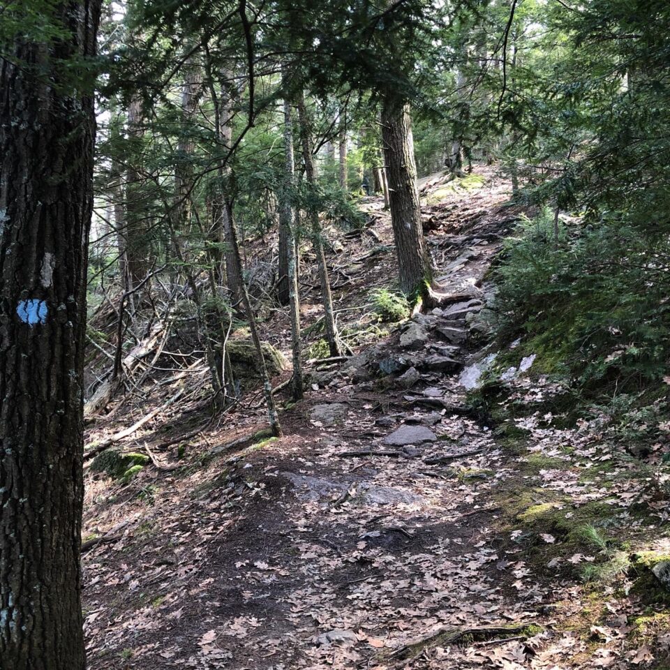
When you ask people what Edmonds was like in the early days, most people say it was a small town, somewhat isolated, located amid a thick forest, with logging camps nearby, and shingle mills lining the eastern shore of Puget Sound. One of the things that is seldom mentioned are the few roads and often heavily used trails that were instrumental to the early settlers’ survival and the town’s eventual success.
Fortunately, numerous early memoirs and letters provide us with glimpses as to where those roads and trails were, who built them and why they were important to the settlers’ survival and eventual success of the city.
Pathways to the south
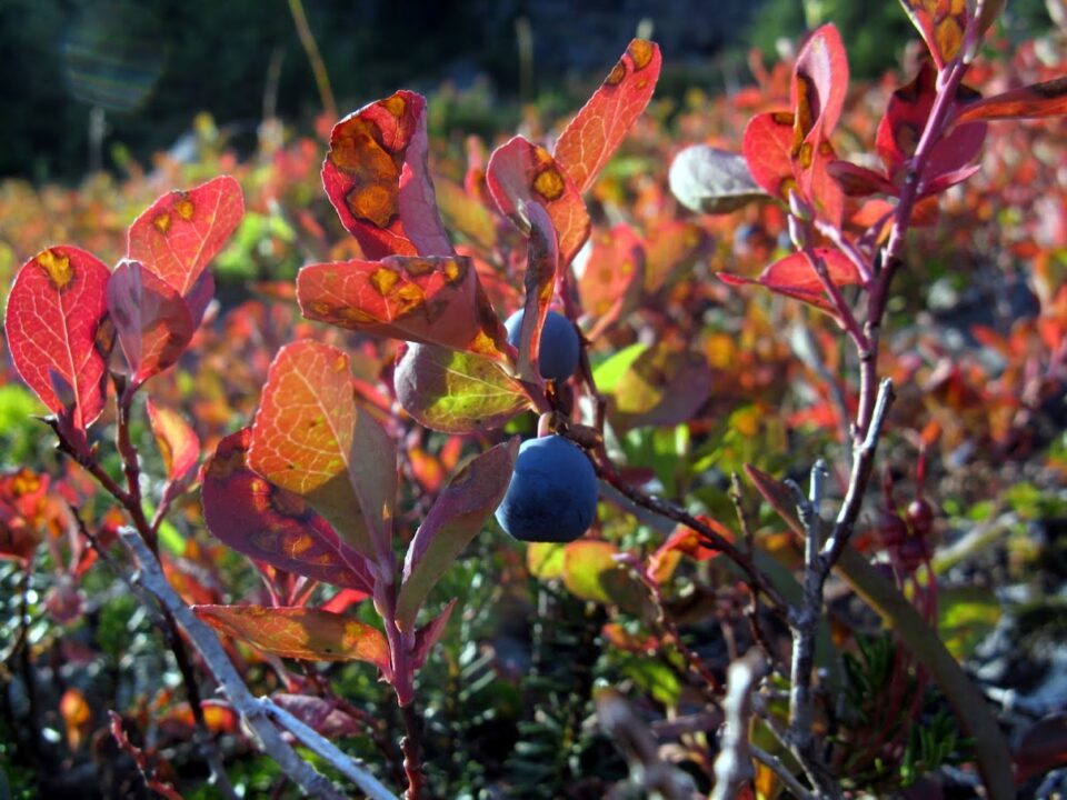
To the south, located both to the west and east of the Edmonds Marsh, were narrow walking trails or pathways that led southward from Edmonds toward Point Wells and Richmond Beach. The marsh was an important destination for many of the early settlers. It was a rich habitat filled with both flora and fauna. Marsh and shore birds were abundant. The waterfowl were hunted at times and other birds’ eggs were gathered for food.
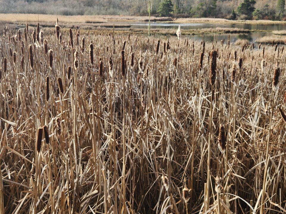
Reeds and cattails were abundant and harvested during different times of the year for a variety of reasons.
Cattails’ long leaves were woven into durable mats for flooring or as insulation in cabin walls. The early settlers also used them to make baskets, hats and bags. The young shoots were eaten boiled or raw, while roots were harvested for their high starch content.
Later in the summer, cattail brown seed heads were gathered and used to stuff pillows and mattresses and insulate clothing. With the scarcity of kerosene at times, dried stalks were also used as torches, with the seed head dipped in animal grease and then lit.
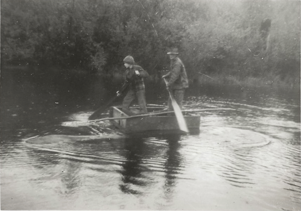
The narrow path east of the marsh also led to several small freshwater ponds that were home to fish. As late as the 1930s, according to June Sorensen Crump who was born in Edmonds in 1925, the ponds also acted as swimming holes for kids in the summer and skating rinks during the winter.
Beyond the marsh, the bumpy paths converged and headed westward to the Great Northern Railway tracks and down to the beach.
Pathway to the southeast
In the early days, a trail led out of the town to the southeast, uphill, where it eventually intersected with a logging road. The intersection was near the homestead of Anna Elizabeth Galloway. When Anna first filed the homestead in 1888, she was a single woman who resided on 143.98 acres of land including a small bog-like lake that was known then as Anna Lake.
Anna Lake is now known as Chase Lake and is located on 84th Avenue west, approximately three quarters of a mile south of Five Corners.
The rough trail had been cut through thick underbrush leading up the hill from above Dayton Street to the logging road. Along the way, the trail crossed over several streams and small wooden bridges had been built to span the waterways. Recollections reflect the fact that along the trail there were two small clearings filled with wildflowers and wild huckleberries, which were harvested.
The trail, although crude by any standard, was heavily used, as Anna was well known as the best midwife in the area.
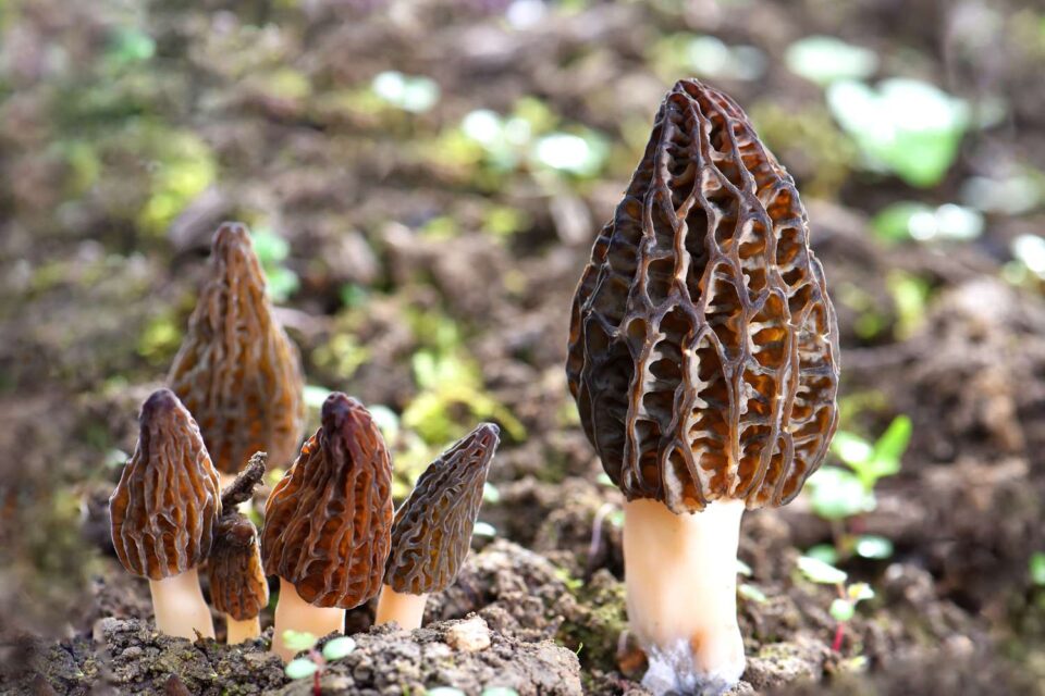
Other narrow paths were also created off the logging road into the dense woods where reportedly Morel mushrooms and other edible fungi were gathered.
Pathways to the east
From where the eastern city limits and George (Main) Street ended, a heavily trafficked muddy skid road had been constructed up the hill to the east. At the top of the hill, the skid road veered slightly right and headed east for about half a mile to an area near current day Five Corners.
From around that area, records indicate that there were at least three to four trails or narrow roads that led eastward in the 1880s and 1890s.
In Ray Cloud’s book Edmonds: The Gem of Puget Sound, he notes: “The mail service in 1884 was a far cry, from that of today. Once or twice a week a lone horseman made his meandering way through the woods, along narrow Indian trails, south past Lake Ballinger, then Lake McAleer, and skirting the northern tip of Lake Washington to the village of Bothell. There outgoing mail would be exchanged for incoming, the saddlebags replaced on the horse and the trail retraced, after which the mail would be distributed to the settlers as best it could.”
The round trip through the forest and several clearings and over multiple streams took two to three days dependent upon the weather.
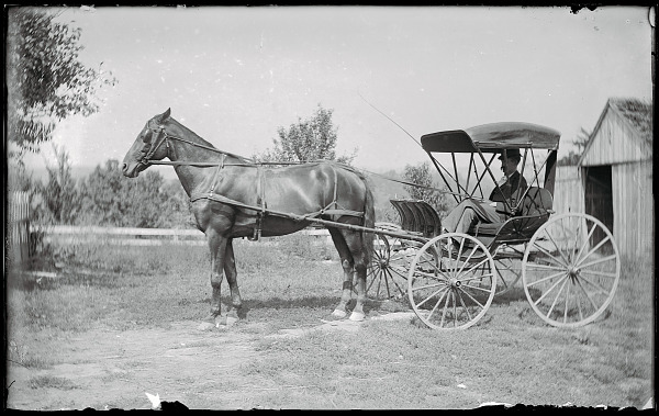
In a 1976 interview, Edna Anderson, who had arrived in Edmonds in 1895 at age 11, recalled different roads heading east. “As a young girl I lived with Dr. R. L. Chase, Edmonds’ pioneer doctor for a while. I used to pack his doctor’s bag. He used to ride across the rugged trails to Bothell in his horse and buggy, just to help someone.”
Eleanor Sill Milholland, granddaughter of Edmonds founder George Brackett and his wife Etta Brackett, wrote of possibly a different path to the east in her memoirs.
“My mother recalled how her sister Nellie and the Deiner girls would walk over to the north end of Lake McAleer (now Lake Ballinger) gathering wild berries along the way and visiting Mr. and Mrs. Bartholomew.”
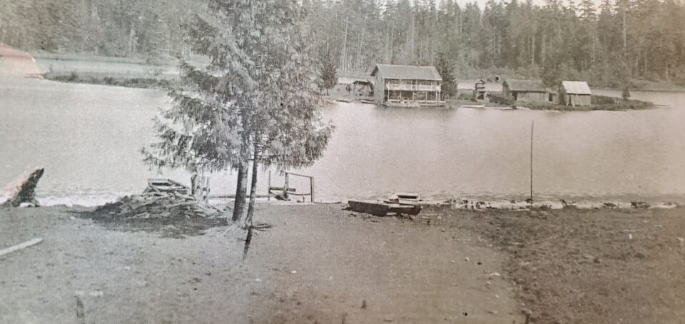
Following a trail from Edmonds to the north end of Lake Ballinger, depending upon the route, would have meant a trip of three to four miles over up-and-down terrain and through thick wooden areas. The girls would have encountered creeks and fallen logs, but the rewards were the wild berries they foraged and at the end of the trip was the rowboat ride to the Bartholomew residence, which was located on an island in the middle of Lake Ballinger. The Bartholomews also had an extensive garden, and they often shared vegetables with their guests. Of course, the girls had to walk back home toting their bounty with them.
Roads further to the northeast and north
In 1888, Louis Arp began homesteading three miles north and east of downtown Edmonds. His homestead was located where James Village is today. His property was reportedly so dense with timber that he couldn’t see any daylight unless he looked upward.
With the help of loggers, he cut down trees and built a puncheon or plank road westward, down the hill to the shingle mills in Edmonds.
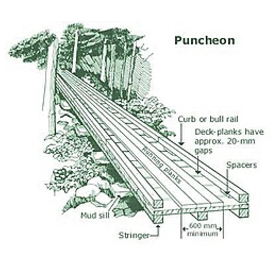
A plank or puncheon road was a road built out of wooden planks or puncheon logs. These roads were a means by which early settlers could traverse soft, marshy or rugged terrain, whereas skids used on skid roads would sink in the wet soil.
According to historical records, it took Louis Arp over a year to construct the road. It, however, became one of the two main roads into and out of Edmonds, later being extended to Alderwood. Initially it was known as Arp Road. Today we recognize the road as 196th Street Southwest.
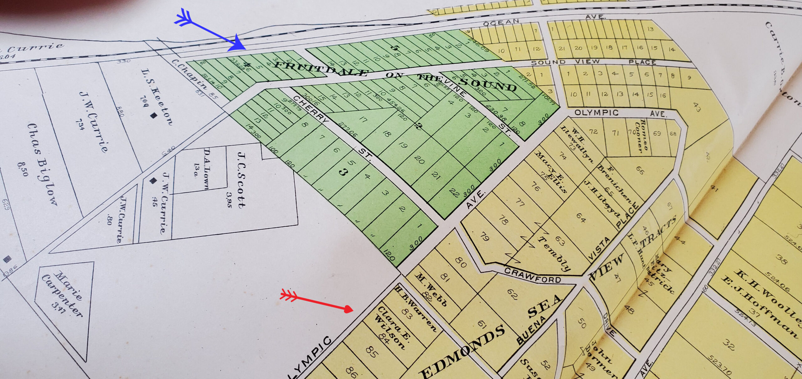
In addition to Louis Arp’s undertaking, soon after Edmonds’ incorporation in 1890, major real estate developments began directly to the north of the city via the Fruitdale on the Sound and Edmonds Sea View Tracts subdivisions. A dirt road was built between the developments heading northward for approximately half a mile. Beyond that point, there weren’t any roads or public transportation to the north, except by steamboat.
The road was initially named Olympic Ave but later was affectionately known as Snake Road when it was extended further north and wound itself along the steep hillsides above Puget Sound. Today it is known as Olympic View Drive.
But according to multiple accounts, the end of the road didn’t mean that all travel stopped there. The forest beyond the developments reportedly had several well-worn trails that led to open meadows, and an abundance of wild fruits and flowers.
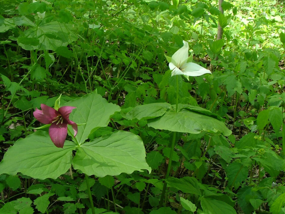
Reminiscing, Adrienne Casper, who taught in the Edmonds School District for 41 years and whose family lived on the northern outskirts of town, recalled: “We roamed through the woods on trails looking for wild blackberries, red huckleberries, salmon berries, blackcaps, blueberries and Oregon grapes. In the fall we picked wild hazelnuts. We liked to gather trilliums, twin flowers, johnny-jump-ups, sweet-after-death (vanilla leaves) and dogwood blossoms. Many times, we stumbled into a bee’s nest and later came back and extracted honey.”
Author’s note: Caspers Street to the north of downtown Edmonds is named after the Caspers family.
Frances Anderson, renown Edmonds educator, also recalled an instance when as a teenager she had followed the road to the northeast and had ventured off the road, up into the woods, picking wild blackberries.
“We were foraging for blackberries one summer and I was working my way around a large clump of blackberry bushes that were about eight feet tall. As I was reaching up to pick some of the larger berries I heard a rustling sound about ten feet away on the other side of the patch. I slowly moved around the edge to see who was there and to my surprise there was a large black bear gorging itself on the berries. I slowly backed away and the bear just kept on eating.”
Trail to the north along the waterfront
From Edmonds’ city limits along the waterfront above the Great Northern railway was a well-traveled dirt road that led northward. The road was known as Ocean Avenue, and it extended north 200 yards beyond the Fruitdale on the Sound development.
In the remembrances of Adrienne Caspers, Frances Anderson, Mrytie Rynearson and others, each reflected on walking north along the road above the railroad, crossing the railway tracks and then traversing a wooden stairway down to the beach. The stairway had to be replaced each year as the winter storms’ waves would destroy it.
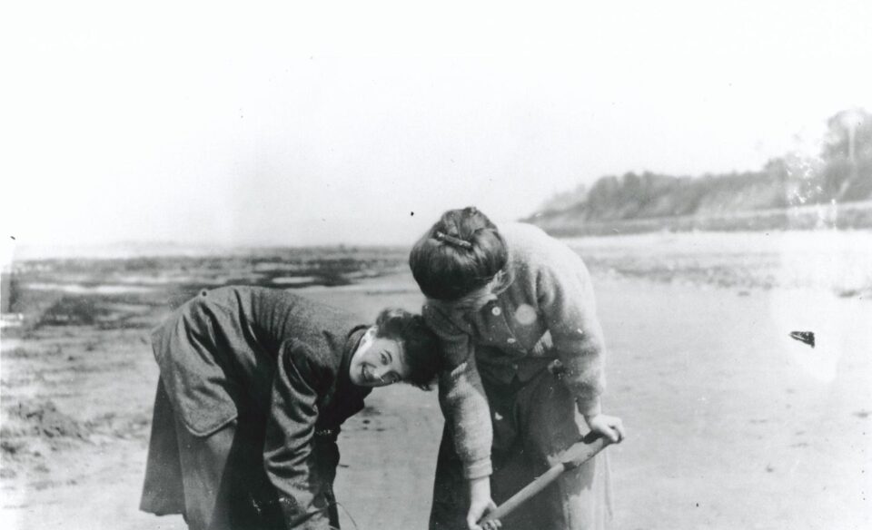
On the beach, they reminisced about digging clams, catching crabs and visiting the fish traps that had been set up north of the city. As Adrienne recalled “for 25 cents you could get a salmon, that was so large, that we could hardly carry it home”.
Above the beach on the bank were large rocks that were full of agates, and the girls would chip off pieces to take home as prized possessions.
Numerous historical accounts reflect the fact that salmon and other fish were caught in abundance from the shore north of the city by early settlers, providing much needed food beyond what they were able to raise on their properties or gather in the forest areas.
Intercity forgotten trails and pathways
When Edmonds was incorporated in 1890 there are written memoirs that referred to a trail that led upward from the northeast corner of the Edmonds Marsh (slew/slough), through the woods and around the “swamp” just south of George (Main) Street. I personally had never heard of a swamp being in the heart of downtown Edmonds nor a trail around it.
However, I recently discovered the hand-drawn map pictured below that was dated 1889-1890 which shows a swamp just south of George Street between Fourth and Fifth Avenue.
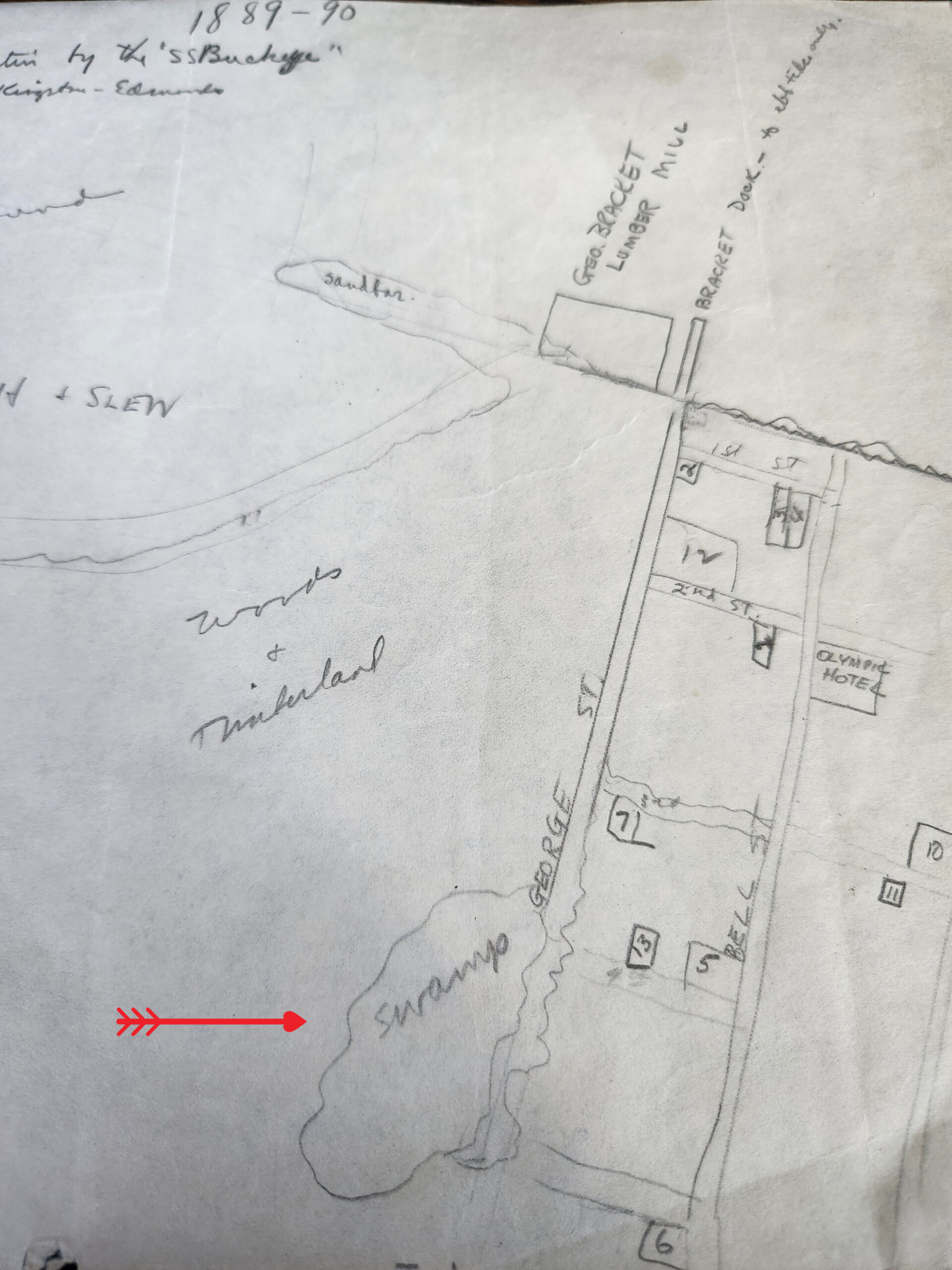
Although the map does not show a trail south of the swamp, it is not hard to imagine a trail existing through the woods/timberland southwest of the swamp. It would have provided an alternative route to and from the Edmonds Marsh area, instead of walking down George Street into the lower section of town, which was filled with saloons, cardrooms and shingle mills.
Similarly, when I researched and wrote about Edmonds’ early schools, I had read accounts of students walking to school across planks on top of a swamp, but I never could pinpoint where the swamp was located. When I discovered the hand-drawn map above, I also discovered another hand-drawn map dated 1908-1912.
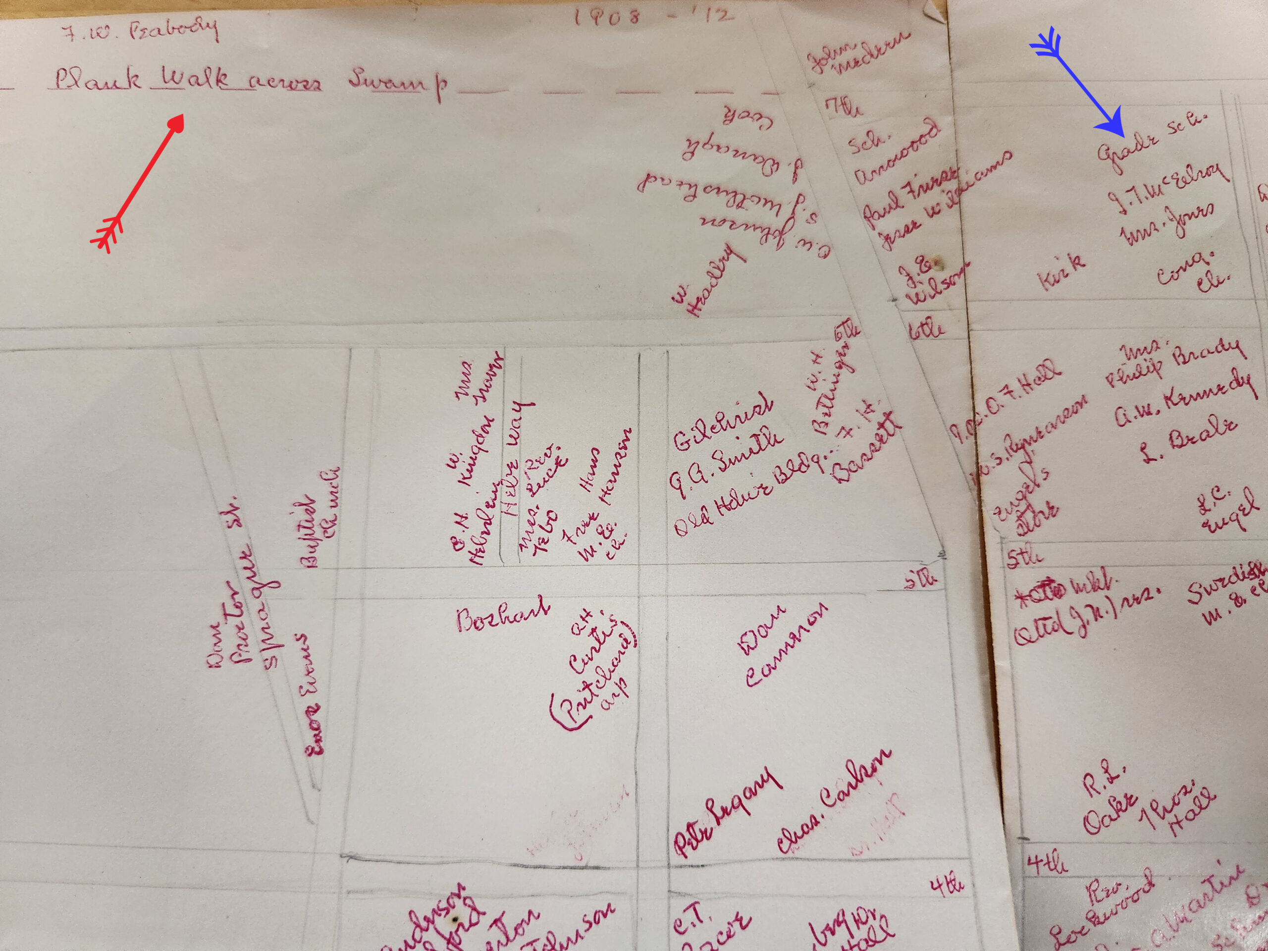
In the upper left section of the map, you can see a reference to a “plank walk across swamp.” Assuming the map is not drawn to scale, it is hard to determine exactly where the swamp was located, how large it was or how many years a plank road had been used to traverse it.
The plank walkway appears to have been in or near the northeast corner of the city limits just above 7th Avenue. It is reasonable to assume that it had the characteristics of Louis Arp’s plank road, and it was necessary for students to traverse it, to get to the grade school.
In reflection: As time went by, the trails to the east were extended, intersecting with North Trunk Road (Highway 99), and further east to the Seattle-Everett Interurban Railway. Although the trails’ exact routes are not known, they most likely were the forerunners of 212th and 220th Streets Southwest.
Other trails eventually disappeared. Some were covered over with dirt, houses and cement. Others were simply no longer used.
In retrospect, it is simplistic to think of early Edmonds as a fledging town whose citizens were totally isolated and survived solely upon goods brought by steamboat from Seattle or Everett. Edmonds’ early settlers, including homesteaders on the outskirts of town, toiled to build roads, trails and paths through the dense woods and along the shorelines to enhance their existence through foraging, hunting and fishing. In doing so, they also increased mobility, which provided better mail service and allowed doctors, midwives and others to reach those in need in an expedited manner.
Thanks go to the Edmonds Historical Museum, The Washington State Park Service, The National Park Service, The U.S. Forest Service, The Museum of American History – Smithsonian and June Sorensen Crump for their assistance in researching this article.

Real first and last names — as well as city of residence — are required for all commenters.
This is so we can verify your identity before approving your comment.
By commenting here you agree to abide by our Code of Conduct. Please read our code at the bottom of this page before commenting.